UN New World Map Projection: Cartography or Politics of Power
The challenge is not whether we can draw a different map, the challenge is whether, having seen the distortion, we are willing to question the world we thought the map was showing us.
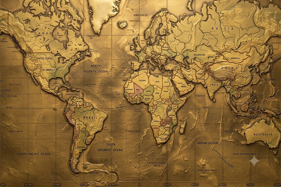
[Gemini AI image used here for representation.]
The United Nations has just done something that may appear almost trivial at first glance. It has voted to encourage the world to reconsider the map through which it represents itself. There are no armies involved, no borders being redrawn, no territory being transferred from one sovereign state to another. Yet beneath what looks like an obscure cartographic decision lies a question far larger than geography:
Who has the authority to represent the world, and what happens when a representation becomes so familiar that we mistake it for reality itself?
On Friday, the UN General Assembly backed a resolution promoting the Equal Earth projection as a more accurate representation of the relative size of the world’s continents. The resolution received 164 votes in favour. The United States voted against it, while six countries abstained. The initiative was led by Togo and supported by African countries and the African Union.
At one level, this is a debate about cartography. At another, it is a debate about power.
For centuries, human beings have drawn the world on maps, but no map has ever been the world itself. Every map is a selection. Every projection makes choices. Every representation brings some features into prominence while diminishing others. A spherical Earth cannot be transferred onto a flat surface without distortion. The question, therefore, is not whether a map distorts reality. It is which reality it chooses to preserve, which distortions it accepts, and what those choices teach us to see as normal.
That is where cartography stops being a technical discipline and becomes a question of politics, history and consciousness. The map we learn becomes the world we imagine Most people encounter the world first through a map.
Long before they travel across continents, study international relations or begin to understand the history of colonialism and global economics, they see a map in a classroom. Continents occupy certain amounts of space. Some countries appear enormous. Others seem comparatively insignificant. Certain regions appear to sit at the centre of the world, while others are pushed towards its margins. The visual lesson is absorbed before it is consciously analysed.
The map is therefore one of the earliest ways in which a child learns not simply where places are, but how the world is organised. For generations, millions of children have grown up with maps based on the Mercator projection, developed by Flemish cartographer Gerardus Mercator in 1569. Mercator had a legitimate and important purpose. His projection was designed for navigation because it preserves directions and angles in a way that made it particularly useful to sailors travelling across the oceans.
But a map designed to help a ship maintain its course is not necessarily the best map for teaching humanity what the Earth looks like. That distinction has been largely forgotten.
The Mercator projection dramatically enlarges landmasses as they approach the poles. Greenland can appear almost comparable in size to Africa. In reality, Africa is about fourteen times larger than Greenland. Europe and North America also appear substantially larger than their actual proportions, while Africa, South America and other equatorial regions are visually reduced. The distortion is not a secret conspiracy. It is a mathematical consequence of attempting to represent a sphere on a flat surface. Mercator did not sit down in 1569 with the intention of diminishing Africa or enlarging Europe. That would be a historically indefensible claim.
But historical consequences do not always depend upon historical intentions. A representation created for one purpose can acquire another meaning when it becomes the dominant representation through which generations learn to understand the world. A navigational tool can become an educational image. An educational image can become a cultural habit. A cultural habit can become an unconscious assumption.
That is the more profound issue raised by the UN resolution. Africa does not become larger because a different map makes it look larger. Europe does not become smaller because a different projection reduces its visual prominence. The physical world remains exactly as it was.
What changes is the relationship between reality and the image through which reality is perceived. And that relationship matters.
Colonialism did not invent the Mercator map. There is an important historical distinction that should not be lost in the political argument. It would be simplistic to claim that Mercator deliberately created his projection to make Europe look powerful or Africa look weak. He did not. His projection emerged from a practical navigational requirement in sixteenth-century Europe. But the fact that Mercator was not responsible for later colonialism does not mean that cartography and colonial power developed independently of one another.
Mercator’s projection appeared at precisely the beginning of the period in which European maritime powers were extending their reach across the oceans. Navigation facilitated commerce; commerce facilitated expansion; expansion eventually produced systems of conquest and colonial rule on a global scale. The map did not cause this transformation, but it became part of the intellectual world in which that transformation took place.
There is something deeply significant about who historically acquired the power to map the world. European explorers mapped territories they encountered. Colonial administrations surveyed and classified populations and resources. European institutions named places, established boundaries and produced geographical knowledge that was subsequently treated as authoritative. Maps were not simply descriptions of territory. They were instruments through which territory could be known, administered, claimed and governed. The colonial map could turn a living landscape into a possession.
A river became a boundary. A forest became a resource. A community became a population category. A territory became a colonial administrative unit. A line drawn on paper could eventually determine where one people belonged and where another supposedly began. This is why the politics of cartography cannot be separated entirely from the history of colonialism.
For centuries, Europe was not merely represented as one region among many. It became the intellectual centre from which much of the world was measured, classified and interpreted. European geographical knowledge acquired the status of universal knowledge. European political categories became international categories. European historical experience was repeatedly presented as the template through which modernity itself was understood.
The map became part of that architecture. This does not mean that every child looking at a Mercator projection is being subjected to colonial propaganda. The argument is subtler and more consequential.
Representations create habits of thought. If one continent repeatedly appears smaller while another repeatedly appears larger, the eye becomes accustomed to the distortion. If one region consistently occupies the visual centre while another remains near the margins, the hierarchy begins to feel natural. What is repeatedly seen eventually becomes what feels normal, and what feels normal is rarely subjected to interrogation.
That is how power can survive without announcing itself as power.
The Equal Earth question
The Equal Earth projection, developed in 2018 by cartographers Tom Patterson, Bojan Šavrič and Bernhard Jenny, approaches the problem differently. It is an equal-area projection, designed to preserve the relative surface areas of continents while maintaining shapes that remain reasonably recognisable.
It is not perfect, because no flat map of a spherical planet can be perfect. Every projection involves compromise. One may preserve area while sacrificing some shape. Another may preserve angles while distorting size. Another may offer useful distances in particular circumstances while creating distortions elsewhere.
So, the argument is not that one map is completely truthful and another is completely false. The more interesting question is: what truth is the map being asked to preserve? For navigation, Mercator has a legitimate technical purpose. There is no reason to pretend otherwise. The UN resolution does not prohibit its use, nor does it eliminate the need for specialised projections in navigation and other technical applications.
But if the purpose is to teach children the relative physical size of the world’s continents, an equal-area projection makes a different and arguably more appropriate choice. That distinction is essential.
A map can be extremely useful and still be a poor representation of something else. A photograph taken through a particular lens is not false because it has a particular field of view. But if that photograph becomes the only image people ever see, they may eventually confuse the limitations of the lens with the nature of the world. The same principle applies to maps. The problem begins when a map designed for one purpose is treated as though it were a neutral picture of reality itself.
Why did the United States oppose it? The most revealing aspect of the UN vote may therefore not be the 164 countries that supported the resolution, but the identity of the country that opposed it: the United States. Washington criticised the initiative as ideological and argued that the United Nations should concern itself with more pressing problems rather than debates involving sixteenth-century maps, reparations and what it described as “cognitive justice.”
There is a reasonable argument that the United Nations faces overwhelming practical crises: war, occupation, displacement, hunger, poverty, climate change, debt, refugees and the continuing erosion of international law. These are matters of immediate consequence. But the existence of more urgent problems does not make representation irrelevant.
Power is not exercised only through armies, economic sanctions, military alliances and diplomatic institutions. It is also exercised through language, categories, knowledge, images and assumptions.
Who names a country? Who draws its borders? Who writes its history? Whose knowledge is treated as authoritative? Who decides what constitutes development? Who defines which societies are modern and which are backward? Who determines which history becomes universal history and which history becomes a footnote? These are not abstract questions. They have shaped international politics for centuries.
The demand for a different world map is therefore part of a much broader demand emerging from the Global South: that the authority to define the world should no longer belong overwhelmingly to those who historically possessed the greatest political and economic power.
Africa is not asking to be made larger. It is asking why a representation in which Africa is visibly diminished became so normal in the first place. That is a very different question.
A map cannot redistribute power At the same time, the symbolism should not be allowed to become an illusion.
Changing a map will not redistribute global wealth. It will not end occupation. It will not cancel Africa’s debts. It will not dismantle unequal trade arrangements. It will not recover resources extracted during colonial rule. It will not compensate communities devastated by centuries of exploitation. It will not alter the distribution of military power between states. A more accurate map cannot, by itself, create a more equal world.
Nor is the UN resolution legally binding. It encourages governments, educational institutions and other bodies to consider the Equal Earth projection; it does not compel the world to abandon Mercator. But dismissing the initiative because it does not immediately transform material power would be equally mistaken. Political change is not always born in legislation or treaties. Sometimes it begins by altering what people regard as normal.
The civil rights movement changed laws, but it also transformed public consciousness. The struggle against apartheid dismantled institutions, but it also challenged the intellectual assumptions that had made racial hierarchy appear legitimate. Decolonisation did not merely transfer flags and administrative authority. It raised a fundamental question about who had the right to define history and knowledge.
The struggle over maps belongs to that same intellectual terrain. If people are taught from childhood that the world is organised visually in one particular way, asking them to look again is not meaningless. It is the beginning of questioning the frame.
The Psychological Geography of Power
Perhaps the most revealing experiment is not even the choice between Mercator and Equal Earth. It is the simple act of turning the map upside down.
Put the Pacific Islands at the top. Put Australia and Aotearoa New Zealand above Europe and North America. Suddenly, a familiar world becomes unfamiliar. Nothing has changed physically. The Pacific has not moved. Australia has not moved. Europe has not moved. Yet the psychological effect can be startling because we have been trained to think of the Southern Hemisphere as “Down Under.”
The phrase itself is revealing. There is nothing in the Earth or in the laws of physics that makes north “up” and south “down.” There is no natural top of the planet. Earth is a sphere turning through space. From the standpoint of the universe, every human map is an act of convention.
Yet after centuries of seeing north at the top, the convention has acquired the authority of truth. Turn the map around and the Pacific Islands are no longer visually relegated to the lower reaches of the page. Fiji, Samoa, Tonga, Vanuatu, Papua New Guinea and the many island societies of the Pacific cease to look like scattered fragments at the bottom of somebody else’s world. The Pacific begins to appear for what it is: an enormous human geography, containing ancient societies, cultures, histories, political communities and civilisations that existed long before many of the states that dominate today’s international system.
Australia no longer sits at the bottom of the world. It is simply somewhere else on the globe. That reversal does not redistribute power. But it exposes something important about perception: we often mistake familiarity for natural order.
The same applies to the conventional prominence given to Europe. Europe is not naturally the centre of the world. It became central to the modern international system because of a particular historical development of economic, military, maritime and political power.
The map did not create that history. But the map can make the resulting hierarchy look geographically inevitable. That is the subtle power of cartography.
Africa’s Moment
There is an additional political significance in the fact that this initiative came from Africa.
For much of modern history, Africa was represented by outsiders. Colonial administrators mapped it. European explorers described it. Foreign governments divided it. International institutions measured it. Western media too often presented it through a recurring vocabulary of poverty, famine, conflict, corruption and instability. Africa has increasingly challenged that external framing.
The campaign for a more accurate map belongs to this wider intellectual movement. It is not an attempt to make Africa appear larger than it really is. It is an insistence that Africa should no longer appear smaller than it really is. That distinction is fundamental.
Africa is not a marginal continent waiting to be discovered by the rest of the world. It is a vast landmass with an immense demographic future, enormous natural resources, extraordinary cultural diversity and a history extending far beyond the colonial period through which it has so often been interpreted. Yet the old visual hierarchy persists.
A child may look at a conventional world map and see Greenland looming over Africa. The child does not know that the visual relationship is mathematically distorted. The child simply sees it. That is why education matters.
A child who grows up seeing continents represented according to their relative area begins with a different visual understanding of the planet from one who repeatedly encounters a map that makes some regions appear much larger than they are. The difference may be almost imperceptible in one classroom.
But societies are built from millions of such perceptions. History is often shaped not only by dramatic events but by the accumulation of assumptions so ordinary that nobody remembers when they began.
Correcting the Picture
The French response is also significant. France has indicated that it will abandon the Mercator projection, with Foreign Minister Jean-Noël Barrot acknowledging the broader significance of representation: changing maps does not change the world, but correcting a distorted representation can be an act of truth.That may be the most sensible way to understand the controversy.
The map will not change the world. But it can change the picture of the world that people carry inside their heads. And pictures matter.
They influence what appears large and what appears small, what seems central and what seems peripheral, what looks powerful and what looks marginal. They influence the unconscious geography through which people organise their understanding of international reality.
For centuries, the world has been marked by extraordinary inequalities of power. The maps used to represent it did not create those inequalities. But representations can make historical hierarchies appear visually comfortable, even inevitable. The Equal Earth projection interrupts that comfort.
It tells the viewer, without saying a word, that Africa is much larger than the familiar map suggested. It tells the viewer that Greenland was never almost the size of Africa. It reminds us that Europe was not naturally destined to occupy the visual importance that history subsequently gave it. And the Pacific example tells us something equally important: there is no natural reason why the peoples and countries of the Southern Hemisphere should live intellectually in a world called “Down Under.”
The point is not to replace one orthodoxy with another. It is to recognise that there is no innocent map. Every projection embodies a decision about what matters most. Every map is an interpretation. The responsible response is therefore not to search for a perfectly neutral map – which does not exist – but to become conscious of the choices that maps make on our behalf. Perhaps that is the real significance of the UN vote.
It is not asking whether Africa can be made bigger on paper. It is asking whether we are prepared to distinguish between the world and the representations through which we have been taught to see it.
That question extends far beyond cartography.
If a map can distort our sense of geographical proportion, what else have we accepted as natural simply because we have seen it repeatedly?
Likewise, if a continent can be visually diminished without losing a single square kilometre, can political and historical realities also be diminished through representation? Or, if for that matter, if a particular region can be placed at the centre of the picture for centuries, can the centre of intellectual attention also become a form of power?
And if the map can be redrawn without moving the Earth, perhaps some of the hierarchies we regard as permanent are less natural than we have been taught to believe. The United Nations has not changed the world map. It has done something more modest and, in its own way, more unsettling: it has invited the world to look again.
The challenge is not whether we can draw a different map. The challenge is whether, having seen the distortion, we are willing to question the world we thought the map was showing us.
[The writer, Ranjan Solomon, has worked in social justice movements since he was 19 years of age. After 58 years of working with oppressed and marginalized groups locally, nationally, and internationally, he has now turned author- researcher-freelance writer focussed on questions of global and local/national justice., Ranjan Solomon has stayed in close solidarity with the Palestinian struggle for freedom from Israeli occupation since 1987. He now also writes on West Asia in the context of the downslide of Western control of the region and Iran’s rise as a significant factor in geo-politics. Ranjan Solomon can be contacted at ranjan.solomon@gmail.com.]
Follow ummid.com WhatsApp Channel for all the latest updates.
Select Language to Translate in Urdu, Hindi, Marathi or Arabic